Frankfurt topographic map
You can find on this page the Frankfurt topographic map to print and to download in PDF. The Frankfurt elevation map present the topography, river and relief of Frankfurt in Germany.
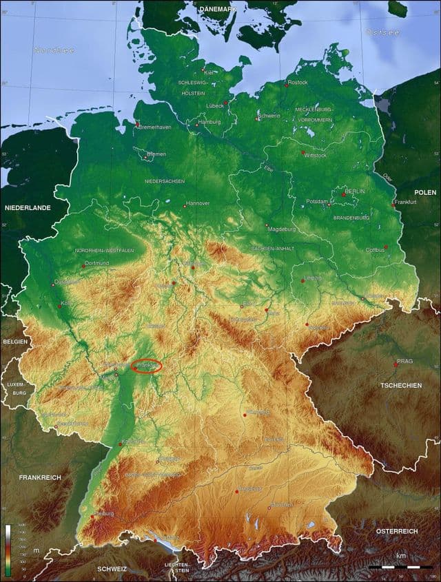
Frankfurt elevation map
The Frankfurt topographic map shows elevation, hills and landforms in Frankfurt. This elevation map of Frankfurt will allow you to know topography, river and relief of Frankfurt in Germany. The Frankfurt topographic map is downloadable in PDF, printable and free.
On Frankfurt elevation map, Frankfurt is located at an average elevation altitude of 113 metres and lies on the Main, a tributary of the Rhine. Frankfurt occupies a central position in Europe. Frankfurt is 393 kilometres from Munich, 399 kilometres from Brussels, 444 kilometres from Amsterdam, 415 kilometres from Zurich, 582 kilometres from Paris. The cities near Frankfurt are Wiesbaden, Mainz, Darmstadt and Offenbach.